After completing the Bue Marino project, my next project in Sardinia took me into the world of 3D cave mapping—a project that combined modern technologies, precision, and patience.
I had seen a short video about this exact project almost a year earlier. Back then, the idea of 3D mapping an underwater cave seemed almost unreal—complex, wildly ambitious, and completely fascinating. I remember watching that footage and thinking: "One day, I’d love to be part of something like this." I’ve always been drawn to the idea of mapping caves, but this—creating digital replicas that can be explored from the surface—felt like the next level. And suddenly, there I was, not just watching it happen, but filming the process myself.
The project took place in Grotta del Fico, a spectacular cave system on Sardinia’s east coast. Same like Bue Marino cave, it’s also accessible to tourists via a dry entrance, where guided tours take visitors through impressive chambers filled with geological formations. As divers, we enter from below—exploring a parallel world that most never see.
From a diver’s perspective, Grotta del Fico is incredibly playful and dynamic. It became my favorite cave in Sardinia not just for its structure, but for its personality. There’s never a dull moment here. You begin by passing under a massive open chamber (artificially) lit from above, where you can sometimes glimpse dry cave visitors tens of meters overhead. Then, as you move deeper, you hit a thick hydrogen sulfide layer that quickly drops you into a zone of almost zero visibility. From there, the cave unfolds like a rollercoaster—chimneys up and down, narrow tunnels, sharp depth changes, and haloclines that create surreal distortions in the water. It's an underwater playground for trained divers and a stunning subject for mapping.
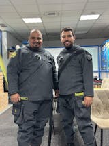
The project was led by Matteo Collina, whose goal was to connect previously mapped sections of the cave with newly explored areas. While I wasn’t one of the mappers, I joined as a videographer—documenting the process, the environment, and the team workflow. This was an incredible opportunity to see the process up close and contribute by capturing the story behind the data.
What Is Photogrammetry—and Why Does It Matter?
Photogrammetry is a method of creating accurate, measurable 3D models from overlapping images. In underwater caves, it becomes a powerful tool for exploration, conservation, and storytelling. Here's how it works:
🖼️ 1. Capturing the Images
Divers swim carefully along the area to be mapped, capturing high-overlap photographs (usually 60–80%) from multiple angles. Video can be used as well, though high-quality stills are preferred for accuracy.
🧠 2. Processing the Data
Once collected, the images are uploaded into specialized software like Agisoft Metashape or RealityCapture, which identifies key points between frames and reconstructs a 3D model. The result is then textured, scaled, and refined to reflect real-world dimensions and features.
🧩 3. Creating the 3D Model
The final product is a digital 3D replica of the cave, which can be used for scientific studies, conservation efforts, virtual tours, or educational outreach. It allows non-divers to see and understand these environments—something that truly impressed me when I first learned about it.
Learning from Behind the Lens
As someone with no formal background in photogrammetry, this project was eye-opening. Watching the divers perform slow, methodical passes with camera in hand, taught me how precise and technical the work really is. Any small mistake—blur, poor overlap, bad lighting—can compromise the model. It often takes multiple dives to get it right, especially in large or complex sections.
GUE is one of the few diving agencies offering photogrammetry training, and this project showed me why it fits perfectly within the GUE framework. It requires teamwork, environmental awareness, consistent protocols, and a mindset focused on both exploration and contribution.
Photogrammetry merges science and art in a way that deeply resonates with how I see diving. It’s not just about going deeper or further, but about bringing something back—data, visuals, stories. Projects like this remind me why I picked up a camera in the first place.
Whether it's for research, conservation, or education, cave projects like this represent diving with purpose—and I can’t wait to be part of more.


